Original sorting
Original sorting
Map Title
Date
No results match for {{query}}
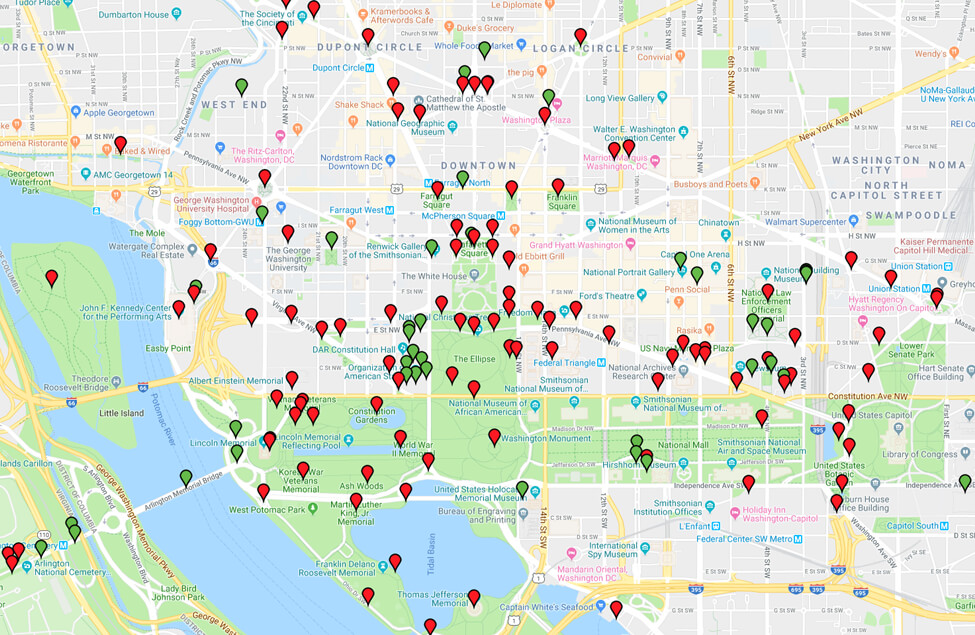
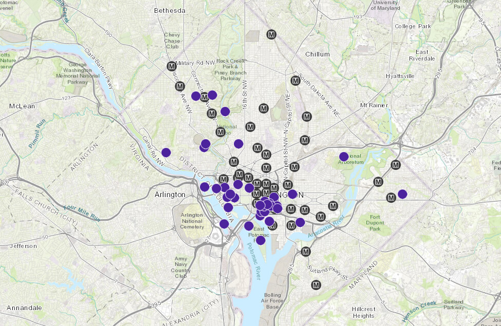
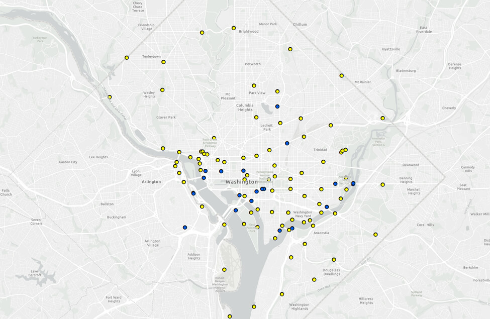
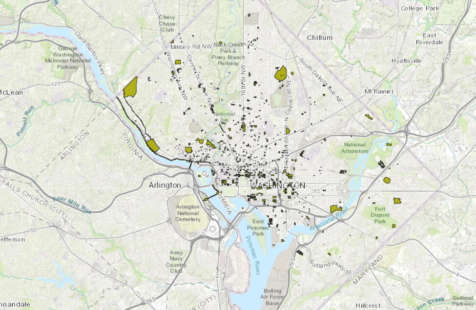
Memorial Map
An interactive map of commemorative works in the nation’s capital, providing location, description, and photos.
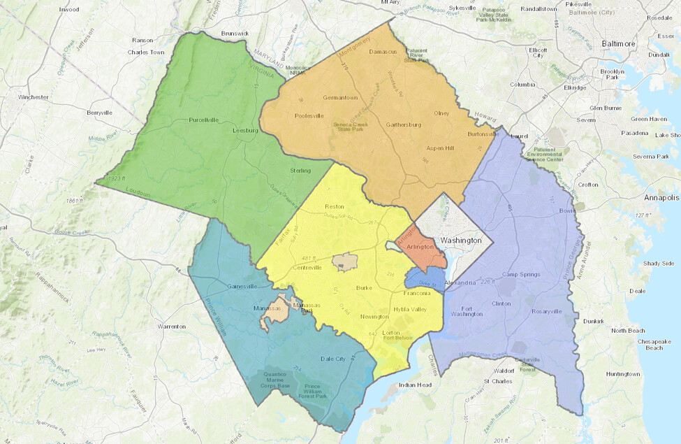
National Capital Region
Area boundaries for the jurisdictions where NCPC has review responsibilities. Our authority varies depending on location and land ownership.
Foreign Missions (2014)
Locations of foreign missions in the region, including chanceries, ambassador’s residences, and other facilities.
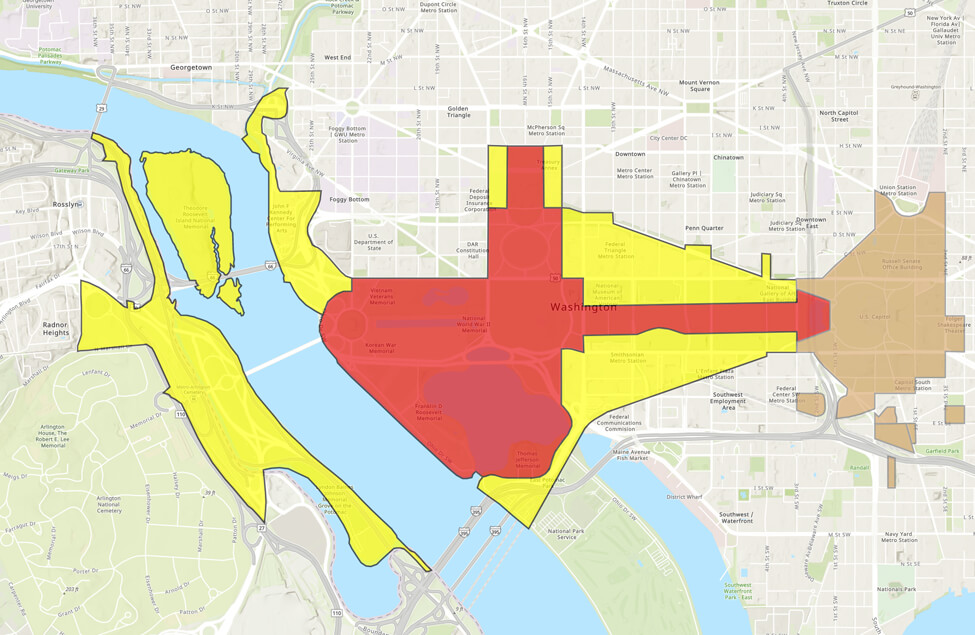
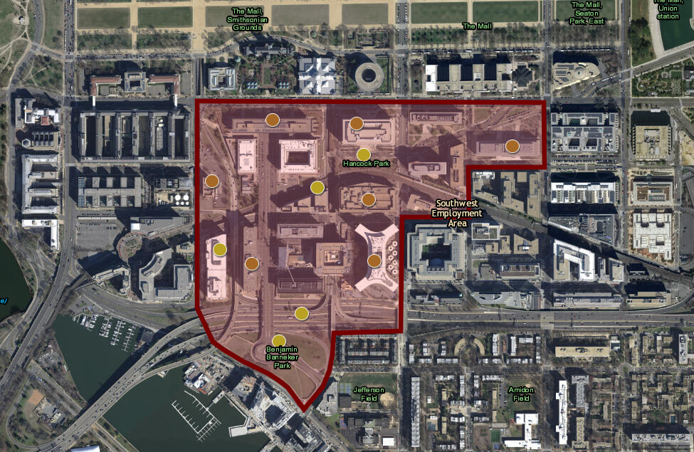
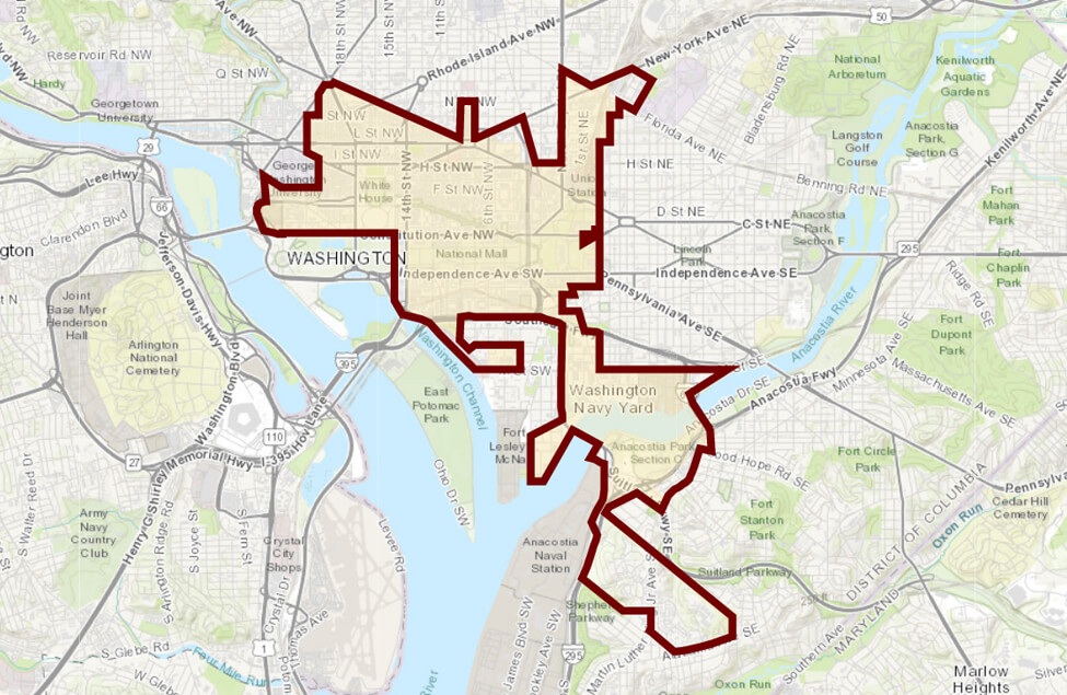
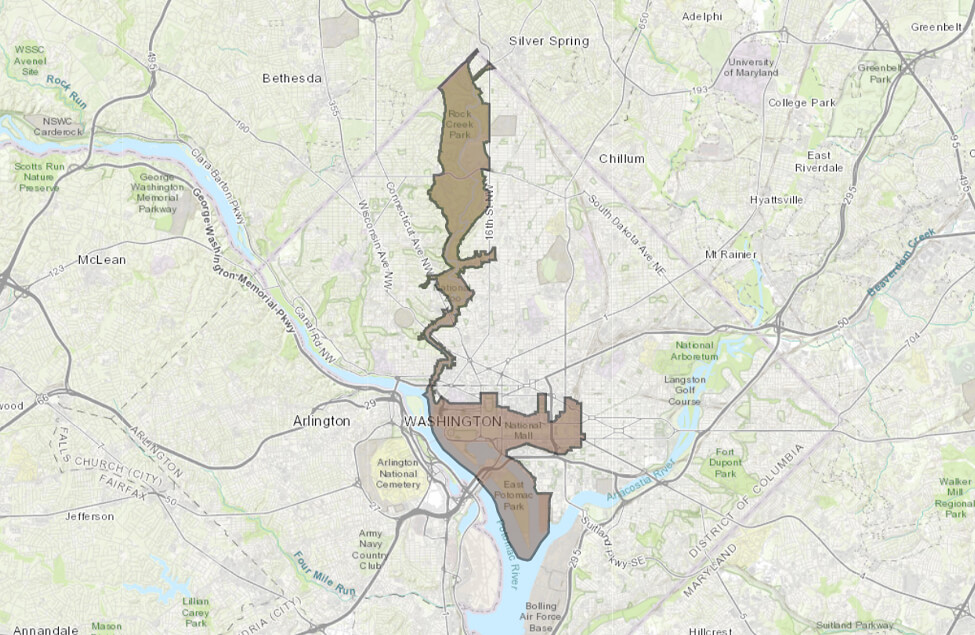
The Reserve
The reserve (red) is an area where no new memorials can be located. Area I (yellow) is for memorials of national significance.
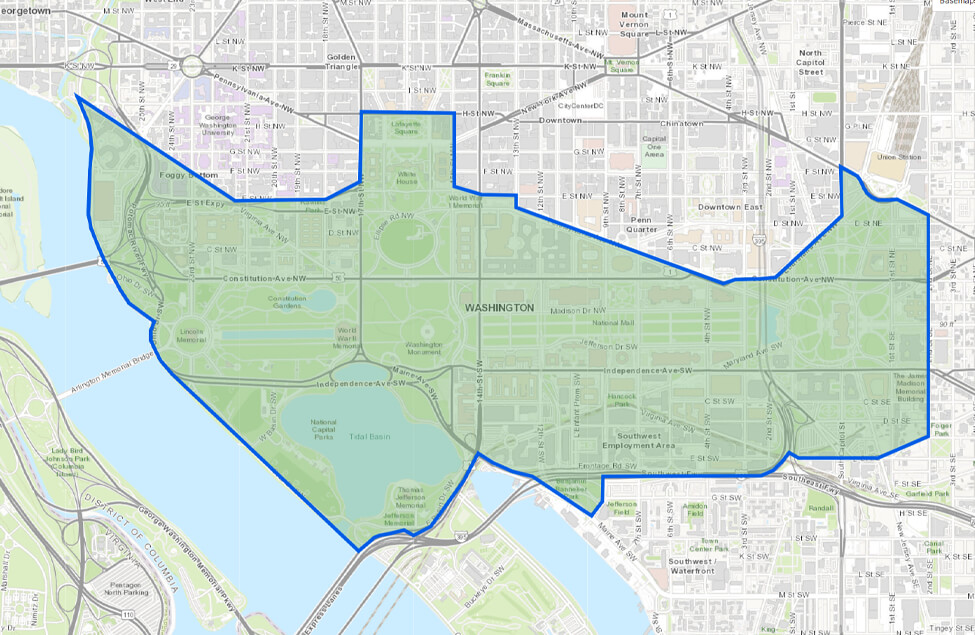
Central Core
NCPC has lead National Environmental Policy Act responsibility for District of Columbia projects in this area.
Capper-Cramton
NCPC’s review authority applies to areas acquired with Capper-Cramton funds and placed under Maryland National Capital Parks and Planning Commission jurisdiction.

Pennsylvania Avenue
Study area for the NCPC, General Services Administration, National Park Service, and District of Columbia Government-led initiative to revitalize one of Washington’s most important streets.
SW Ecodistrict
Boundaries of the predominantly federal precinct that NCPC seeks to transform into a highly sustainable workplace and livable neighborhood.
Modernist Landscapes
Locations of 20th-Century modernist landscapes and buildings in the nation’s, including Metrorail stations.
Memorials and Museum Sites
Locations identified by the 2001 plan as recommended sites for new memorials and museums.
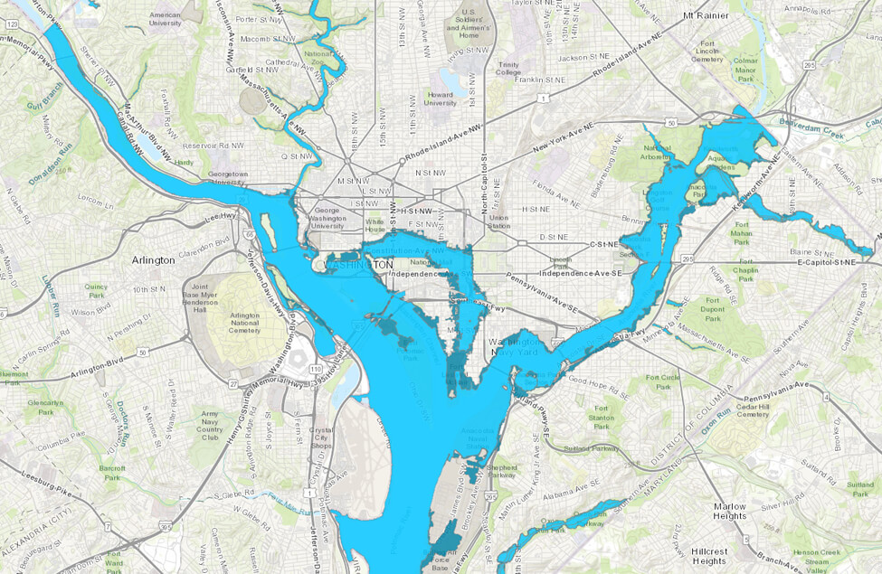
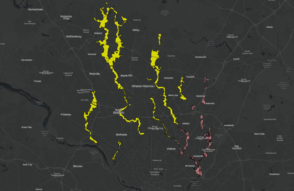
Floodplains
Displays the areas that would be impacted by 100-year (1 percent annual chance) and 500-year (0.2 percent annual chance) floodplains.
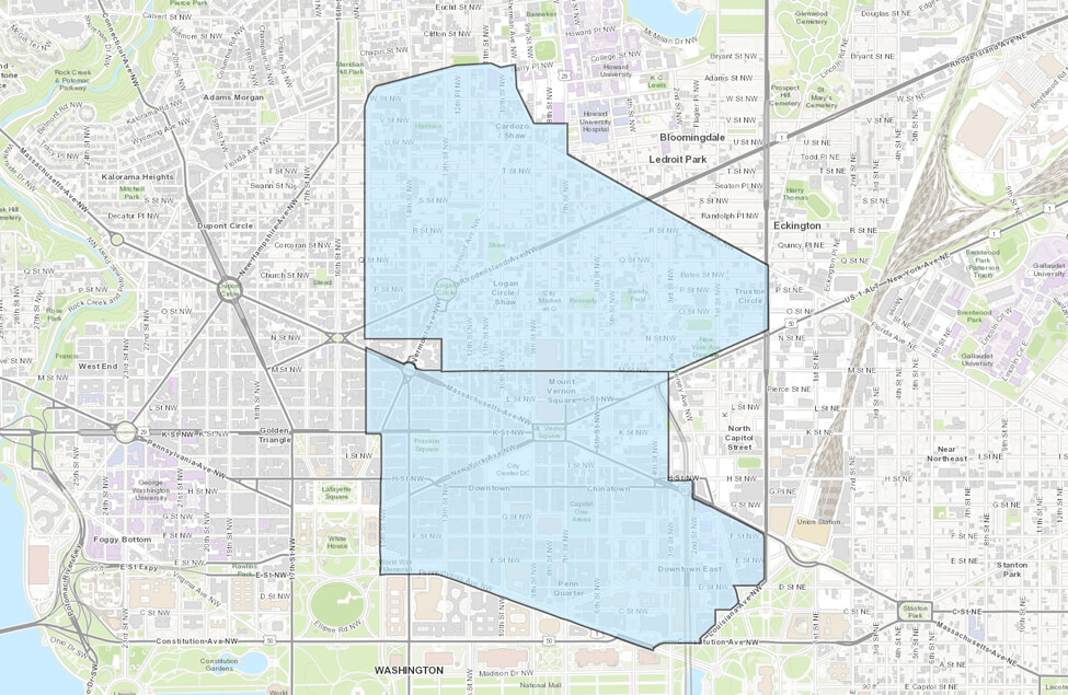
Central Employment Area
Reflects the region’s primary commercial center and concentration of federal employment. Most of its federal facilities are within a quarter mile of a Metrorail station.
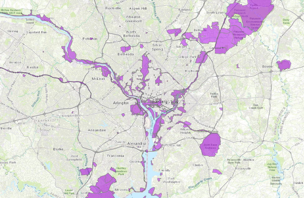
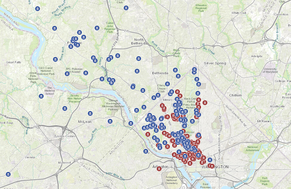
Federal Facilities
Locations of military bases, buildings, and facilities that are owned by the federal government.

Historic Districts
Locations in Washington, DC that are designated as historic districts.
Historic Landmarks
Locations in Washington, DC that have been designated as historic landmarks.
Shipstead Luce
Displays the boundary that was defined in the Shipstead-Luce Act of 1930.
Streetscape Boundary
The geographic area defined by the Streetscape Guidelines and Manual Boundary.
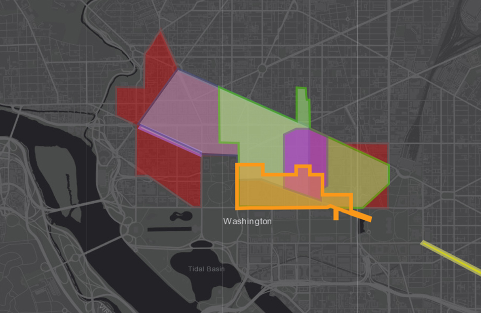
Reimagining Downtown Together
The NCPC-led Pennsylvania Avenue Initiative is one of several concurrent and complementary planning projects working together